Faster Site Report from Above

Unlock next-level construction oversight with Votact’s advanced drone services. From automated aerial progress tracking and high-resolution imaging.

Votact delivers powerful aerial insights

Our autonomous UAV fleet transforms traditional surveying and monitoring, capturing consistent data from the sky, day after day, so you can make faster decisions, reduce costs, and stay ahead of schedule.

Applications

From everyday operational tasks like perimeter checks to strategic functions

Topographic Mapping

Progress Tracking

Structural Inspection

Periodic Inspection

Site Reconnaissance

Automated Inspection Flights

Monitoring High-Risk Areas

Orthomosaic Imaging and Mapping

Progress Tracking with Daily Visual Insights

Monitor your project in real time with daily image capture for accurate progress tracking and decisions.

Documentation for Transparent Reporting

Showcase milestones with high-resolution footage, providing clear visual evidence for stakeholders.

Documentation for Transparent Reporting

Showcase milestones with high-resolution footage, providing clear visual evidence for stakeholders.

Progress Tracking with Daily Visual Insights

Monitor your project in real time with daily image capture for accurate progress tracking and decisions.

Progress Tracking with Daily Visual Insights

Monitor your project in real time with daily image capture for accurate progress tracking and decisions.
Our skilled team will work closely with you to build the tools you need to succeed. We'll brainstorm with you, then create the software to move you forward now and propel tomorrow's growth.Our skilled team will work closely with you to build the tools you need to succeed. We'll brainstorm with you, then create the software to move you forward now and propel tomorrow's growth.Our skilled team will work closely with you to build the tools you need to succeed. We'll brainstorm with you, then create the software to move you forward now and propel tomorrow's growth.Our skilled team will work closely with you to build the tools you need to succeed. We'll brainstorm with you, then create the software to move you forward now and propel tomorrow's growth.Our skilled team will work closely with you to build the tools you need to succeed. We'll brainstorm with you, then create the software to move you forward now and propel tomorrow's growth.Our skilled team will work closely with you to build the tools you need to succeed. We'll brainstorm with you, then create the software to move you forward now and propel tomorrow's growth.Our skilled team will work closely with you to build the tools you need to succeed. We'll brainstorm with you, then create the software to move you forward now and propel tomorrow's growth.Our skilled team will work closely with you to build the tools you need to succeed. We'll brainstorm with you, then create the software to move you forward now and propel tomorrow's growth.

Our team designs automated drone flight paths tailored to your project layout, ensuring consistent, repeatable data capture across the lifecycle

Every project with a focus on automation, accuracy, and actionable insights. Our end-to-end drone workflow is designed to simplify and enhance the way construction projects are tracked, measured, and managed.

Our Approach

Pre-Construction Survey & Modeling

Votact conducts precision aerial surveys using precision cameras and photogrammetry to create high-fidelity 3D terrain and site models.

KEY ACTIONS

Plan flight missions and compliance checks for safe operations.
Capture and compare overlapping high-res imagery for photogrammetric processing.
Generate 3D terrain models, orthomosaics, and accurate volume calculations.
Deliver downloadable GIS/KML/OBJ/LAZ files and integration-ready data for designers and engineers.

Construction Monitoring & Measurement

During construction, scheduled autonomous flights collect consistent visual and spatial data to monitor progress, measure earthworks, and support remote inspections.

KEY ACTIONS

Conduct routine autonomous flights (daily/weekly/monthly) aligned with project milestones.
Produce progress maps, delta volumes and change-detection reports.
Provide high-resolution images and video for virtual inspections.
Package data for integration into project dashboards or AI analytics platforms.

Post-Construction Documentation & Verification

Perform final as-built scans and generate point clouds and textured 3D models.

KEY ACTIONS

24/7 health checks for camera uptime, stream quality, and connectivity.
Supply compliance reports, georeferenced imagery, and archival datasets.
Support handover with easy-to-share files and long-term data storage options.

See More from Above

Fast, high-accuracy aerial insights for surveying, monitoring, and documentation.
Request Aerial Demo

Ai Integration

10+ Cameras Types

Supports variety of camera systems

10+ Million Parameters

Trained on real world data

125 Million Images

Real-Time image processing

Benefits

Accelerate pre-construction workflows with precise aerial surveys and terrain data—reducing planning time and costly on-ground delays.
Stay informed with consistent progress tracking, remote inspections, and measurable site metrics that drive faster, smarter decisions.
Leverage high-resolution imagery and 3D models to validate work against plans, verify volumes, and maintain complete project transparency.
Minimize manual inspections in hazardous zones with drone-based monitoring, improving on-site safety without compromising detail.
Ensure smooth handovers with BIM-integrated as-built data and verified compliance documentation—backed by drone-captured evidence.

Frequently Asked Questions

Explore how aerial data improves accuracy, efficiency, and documentation across every project phase
How often can drones fly on my project site?

Our drones can be scheduled to fly multiple times daily or weekly, providing consistent, automated data capture to track progress and changes in real time.

Are your drone operations compliant with regulations?

Yes, all flights follow local aviation rules. We handle all necessary permissions, ensure firmware compliance (in India) and coordinate with civil aviation authorities as required.

What types of data do your drones collect?

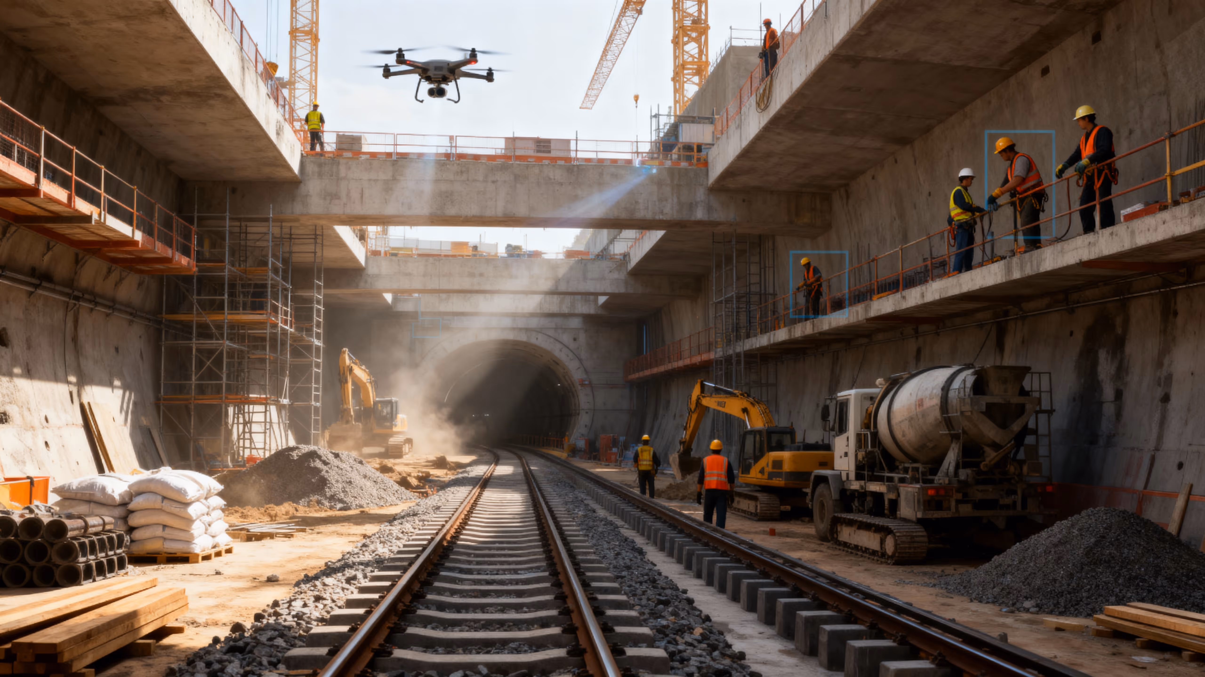
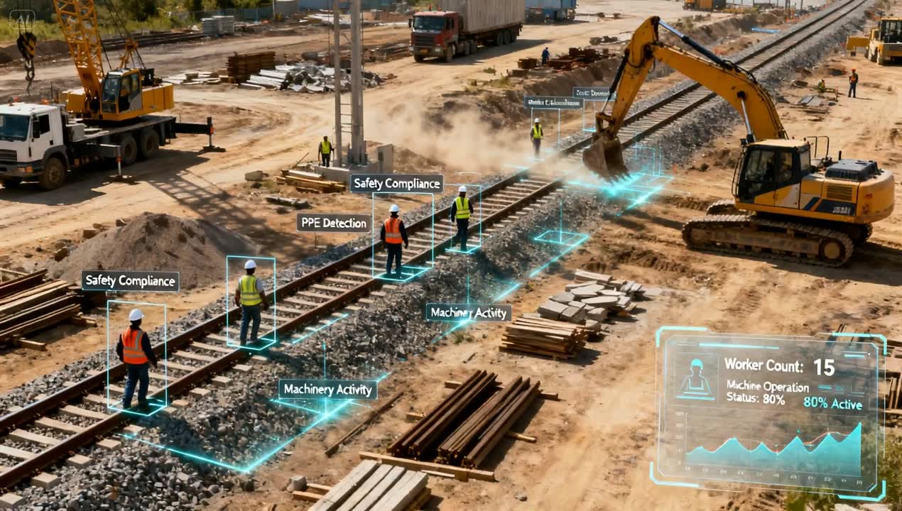
We capture high-resolution photos, 4K videos, Ortho scans, and 3D photogrammetry data. This supports progress monitoring, mapping, volume calculations, and remote inspections.

How do Votact drones improve site safety?

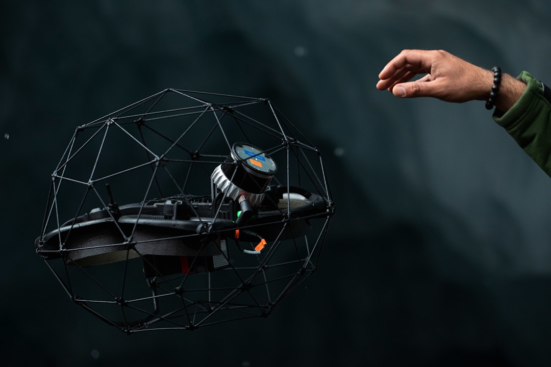
Drones reduce the need for manual inspections in hazardous or hard-to-access areas by providing close-up aerial views, lowering risks for workers and minimizing onsite accidents.