The Lucknow–Kanpur Elevated Highway is a major infrastructure initiative designed to reduce congestion and enhance regional connectivity between two of Uttar Pradesh’s largest cities. The project demanded continuous documentation, precise progress tracking, and high-quality visual media for both technical validation and public communication.
VOTACT was commissioned to provide a unified visual monitoring and storytelling solution—combining aerial intelligence, long-duration timelapse capture, and cinematic video production to document the project’s evolution and strengthen stakeholder confidence.
Challenges
Extended linear site (over 60 km) made continuous monitoring difficult using manual inspections.
Rapid, multi-zone construction required simultaneous visibility across multiple segments.
Safety restrictions and elevated deck construction limited on-site documentation.
Stakeholders required consistent progress updates and engaging visual material for briefings and public releases.
VOTACT Solution
VOTACT deployed an integrated visual monitoring system designed specifically for long-corridor infrastructure projects. Using synchronized timelapse setups, autonomous drone mapping, and cinematic documentation, VOTACT transformed complex field operations into a cohesive visual record of progress, safety, and engineering achievement.
Key Components
Timelapse Monitoring: Permanent camera stations installed along critical spans, capturing continuous footage of pier, deck, and girder installation. Each system operated autonomously with solar backup and cloud-based monitoring.
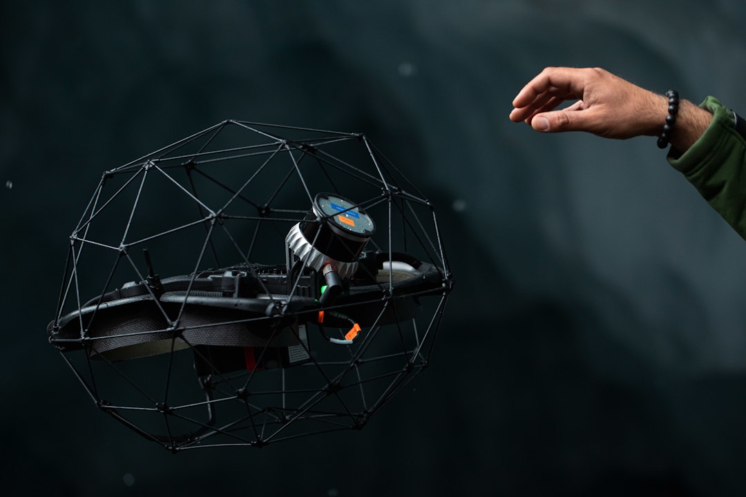
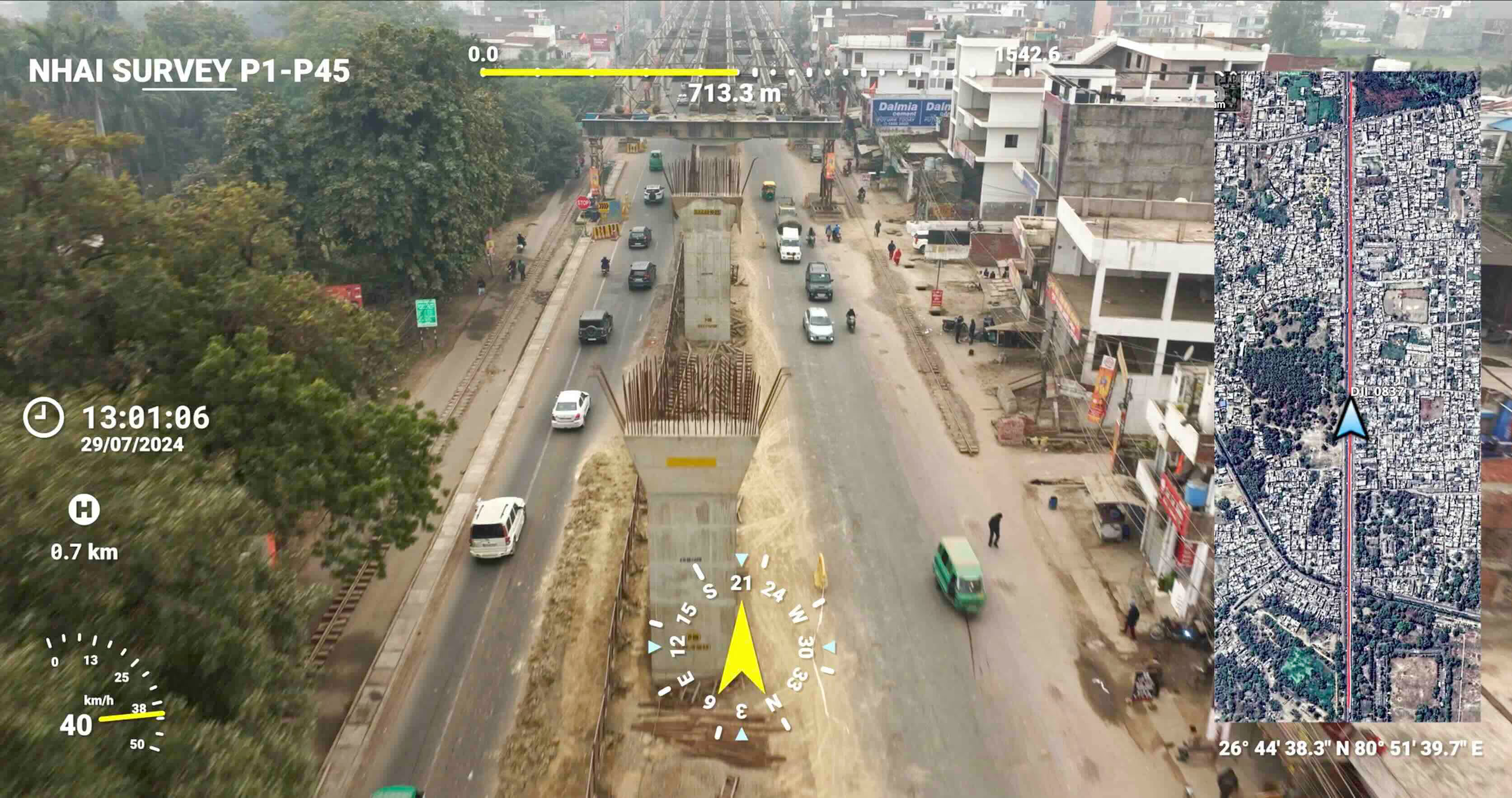
Drone Operations: Weekly aerial flights covered active zones, capturing orthomosaic maps, volumetric updates, and high-resolution imagery for structural inspections and progress verification.
Video Production: VOTACT’s production team created milestone films, short reels, and an end-to-end project documentary showcasing the transformation from groundworks to the final elevated structure.
Implementation
Site Assessment & Planning: VOTACT engineers conducted an initial survey to identify optimal camera and drone vantage points, ensuring comprehensive coverage without interfering with ongoing work.
System Deployment: Timelapse cameras were mounted at strategic intervals, while predefined drone flight paths ensured consistent imaging along the full corridor.
Ongoing Monitoring: Continuous image capture and aerial documentation enabled engineers to track daily progress and compare build sequences.
Media Production: The VOTACT post-production team assembled monthly highlight reels, technical overviews, and public-facing project films for presentations and reports.
Outcomes & Client Benefits
Seamless Project Oversight: Timelapse and drone data gave engineers and project managers real-time visual confirmation of progress across all construction zones.
Enhanced Coordination: High-resolution visuals improved inter-agency coordination, accelerating decision-making and reducing field visits.
Audit-Ready Documentation: Time-stamped visuals supported regulatory submissions and compliance records.
Stakeholder Transparency: Professionally produced video content strengthened communication with government bodies, investors, and the public.
Operational Efficiency: Centralized visual intelligence reduced the need for manual site checks and improved overall project control.
Why VOTACT Delivered Results
Experience in Infrastructure Projects: Proven capability in managing long-duration monitoring for transportation and civil works.
AI-Enhanced Precision: Drone imagery integrated with progress analytics for measurable, data-backed insights.
Consistent Quality Across Scale: Multiple synchronized capture systems ensured uniform visual standards over an extended construction zone.
Cinematic Storytelling: Final films combined engineering depth with visual impact—translating technical progress into a powerful public narrative.
Deliverables
Continuous timelapse footage of construction progress across key segments.
Weekly drone-based orthomosaics and visual inspection data.
Monthly project recap films and a final documentary video.
Structured, date-stamped visual archive for handover and compliance reporting.
Client Impact
The Lucknow–Kanpur Elevated Highway project team achieved improved coordination, reduced field verification time, and stronger stakeholder engagement. VOTACT’s visuals became central to project presentations, internal reviews, and final completion documentation—establishing a transparent record of India’s growing infrastructure capability.
VOTACT’s integration of visual intelligence, aerial analytics, and professional documentation transformed a complex transportation project into a transparent, traceable, and compelling record of progress.